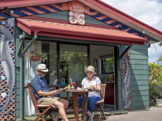
Miria and Taroi of Moanarua Beach Cottage Ōhope offer a unique cultural experience in a romantic hideaway.
Kayaking
Kayak or canoe Whakatane all year round with kayaking adventures and tours for all levels and abilities. Ocean and inflatable kayaks are available for sale or hire now. For more info see below
Featured Kayaking Listings
PACIFIC COAST ADVENTURES & FISHING CHARTERS
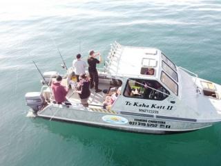
Pacific Coast Adventures offers half or full day fishing charters at the Opotiki Mussel Farm
RIVER RATS RAFT AND KAYAK
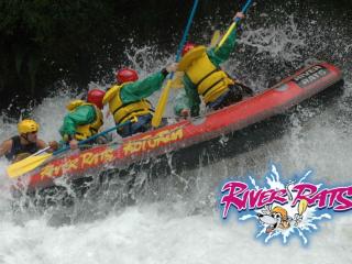
Within an hours’ drive from Whakatane you have 4 different river experiences as well as kayaking adventures to choose from!
Kayaking Map
Kayaking, Canoeing and Paddling Whakatane
Ohiwa Harbour
Ohiwa Harbour offers wonderful paddling, with plenty of beaches to stop for a rest. There’s plenty of open paddling around high tide. Around low tide, there’s less choice but the channels are easier to follow and it’s easier to spot birdlife. Especially on an outgoing tide, the places you can paddle change very quickly.
There are five main islands: Uretara, Ohakana, Hokianga and Pataua. Uretara is administered by the Department of Conservation (DoC). You are welcome to explore this lovely pohutukawa-edged island, though not to camp or light fires.
A great fine-day family paddle is to set off from Ohope Wharf about 60-90 minutes before high tide. Paddle up the harbour (heading west) towards Ohakana and around the back of the island, where there are again overhanging Pohutukawa.
Continue past the racks of growing Ohiwa Oyster Farm oysters and start heading back east. You’ll pass by a small island with yellow sandstone cliffs. Gulls, terns and shags roost here so don’t land, but it’s a neat spot to pause for a rest.
Keep going around Ohakana and you’ll soon be able to see Ohope Wharf again. Head home, hopefully by now with a following tide.
Trip time:
Experienced paddlers 45-60 minutes; families 2-3 hours.
Refreshment/car parking:
At high tide you can paddle up to Ohiwa Oyster Farm, which sells great seafood and other takeaways. At Ohope Wharf, there’s safe parking, a café and toilets. You can launch from the wharf even at low tide.
Other paddles:
You can paddle most of Ohiwa harbour in the two hours either side of full tide. A great trip for experienced paddlers is to start at Ohope Wharf and paddle around Ohakana. Then head around the back of Uretara, passing through a narrow channel between island and mainland. Next go around Hokianga, and back up the main harbour channel to the wharf. This takes an experienced paddler in a fast boat around 2-3 hours.
Safety/environment:
Unless you are experienced, stay away from the harbour mouth in an outgoing tide. Ohiwa tides may well flow faster than you can paddle. Stay alert to boats and in summer keep out of the water-ski lane, east of Ohope Wharf.
The harbour can get very choppy, especially in the main channels, so stay alert to the weather. Please do not land on islands other than Uretara as they are privately owned or managed. And please, stay away from birds and nesting areas, as many species are rare or endangered.
West End to Otarawairere
Otarawairere beach is a stunning spot – with craggy rocky outcrops pushing out into the sea. Shags perch in trees high on the cliffs. Seagulls swoop the sky. There’s a good chance of seeing stingrays, seals, and other marine life.
Paddle out through the waves from West End, Ohope. Head around the point and you’ll quickly see the beach. In settled conditions, landing is straightforward, especially at the Northern end. It’s well worth a wander on the rocks and glorious broken shell sands.
At low tide, you can paddle the channels around the rocky outcrops, several of which form mini islands. Keep looking below you for marine life – who knows what you’ll see.
On the return trip, you may have to check carefully before landing back at West End – there may be waves.
Trip time:
Otarawairere is ideally a trip for exploration and discovery, not time! Paddling to the beach only takes about 15 minutes. But it’s worth spending a couple of hours looking around. Note that if you have any non-paddlers, they can walk from West End to Otarawairere in 20 minutes.
Refreshment/car parking:
There is parking, and toilets, at the road end at West End. There are cafes and dairies at Ohope shops – stop for an icecream. You can also park at the Heads of the Whakatane River. In between, there is no road access: take all you need.
Other paddles:
Depending on energy and fitness, you can continue on around the coast to Whakatane. As with Otarawairere, the right conditions, boats and skills are imperative.
Safety/environment:
If it’s windy, the swells can get large: wait for another day. Early mornings and late afternoons often see the calmest conditions, but check the weather forecast. This is the open sea, so stable boats and appropriate skills are imperative. Low tide is an ideal time to paddle, as more of the coastal environment becomes visible.
Whakatane River
Paddle the Whakatane river and enjoy the relaxed environment as you take in the surrounding views. Paddle at your leisure and look out for boats if you are near the river entrance.
Rangitaiki, below Aniwhenua power station
Keen for action? For white water paddlers and experienced multi-sporters, the Rangitaiki’s Aniwhenua run is a real buzz, with some powerful grade 2 water. With a large catchment, the river has a good flow all year round.
Just a couple of minutes after the put-in at the power station below the billowing Aniwhenua falls, the river squeezes into a narrow chasm. Mossy cliffs rise sharply overhead. You’re faced with a thumping grade 2 rapid: misjudge things here and you’ll be swimming.
After that, things settle down a little. However, there are still several tricky rapids and eddies. The riverside scenery is superb, with lush bush and sparking waterfalls.
The main take-out is accessed from the main Galatea road, 1.2km south of Mangakino stream, where there’s a handy roadside pull-off. Many kayakers then do another run.
Trip time:
For white water kayakers, there’s hours of playing in the rapids. Experienced multi-sporters take about 30 minutes to the main take-out. To the bridge is another 1-1.5 hours; from there to Matahina is another 1-1.5 hours.
Refreshment/car parking:
There’s a pretty picnic spot with toilets at Lake Aniwhenua, just above the dam. You can camp here. To get to the paddle start, drive across the dam, turn right and go to the road end. You can park here.
There’s a real scramble down to the water: it’s far easier to lower the boats down by rope, so bring a 25m length. The put-in itself is tricky, thanks to the water movement from the Aniwhenua falls and power station outflow.
Other paddles:
A good add-on to the main Aniwhenua run is to continue paddling on downriver to the bridge. This takes an experienced multi-sporter about another 1-1.5 hours. From there, you can even carry on all the way to the Matahina dam, for another 1-1.5 hours.
Lake Aniwhenua is a neat place for a family paddle, though it’s pretty weedy. Further up near Murupara, there’s expert-level kayaking.
Safety/environment:
The Rangitaiki is not always close to the road, and much of the Aniwhenua run is down a steep gorge. Once you’ve begun, you’re committed to the full trip. Experience is mandatory – this is not a paddle to be taken lightly. If the Aniwhenua dam lake levels are high, water may be released, dramatically changing water levels.
Downriver from the dam, there are several places where you need to be very alert to the danger of willows.
Waioeka River
The Waioeka river twists down a bush-clad valley south of Opotiki. The river’s a treasure, with plenty of fun grade 1 and 2 paddling and awesome wilderness scenery.
Every October, a section of the Waioeka is paddled by hundreds of competitors in the BayTrust Motu Challenge multisport race. The 27km of paddling is one of New Zealand’s best-loved stretches of river. If you’re fit and experienced, it’s definitely worth experiencing.
The start point is 1km below the Oponae bridge. The first 11km of paddling to Graham’s Bridge (the ‘gravel pit’) has some tricky rapids. This stretch is divided roughly into thirds by EBOP’s Cableway water level monitor and the historic Tauranga bridge.
Further down, the valley opens out. If the water levels are low, paddling can be slow. You need to be fit to tackle the full 27km.
Trip time:
Experienced paddlers 45-60 minutes for the 11km to Graham’s Bridge; and 2-3 hours for the whole 27km. The whole distance is not appropriate for families or the inexperienced –just do a short section.
Refreshment/car parking:
There are no toilets or shops – stock up at Opotiki. There’s roadside parking and river access (up to 5 minutes’ carrying of boats is needed) at:
Start, 34km from Opotiki/1km below Oponae bridge
Graham’s Bridge/’the gravel pit’, 25km from Opotiki
Rest area/angler access 19km from Opotiki
Waioeka gorge mouth, 11km from Opotiki.
Safety/environment:
In summer, water levels in the Waioeka can get very low – a Kevlar or fiberglass kayak could be damaged. Check the EBOP web site for water levels: between 1.6m and 2.0m at the Cableway monitor is ideal. Below 1.45m you may need to portage short stretches; above about 2.2m is for experienced paddlers only.
The river is almost always close to the road, although the gorge edges are steep. Stay away from the willows edging some parts of the lower river. The weather can be a lot cooler and wetter than on the coast.
Lake Matahina
The sparkling blue waters of Lake Matahina, 30km from Whakatane, sit between steep bush-clad hills. The lake is formed by a hydro-electric dam. It offers excellent family kayaking and is an ideal spot for training.
From the dam, kayak up the lake. On the right, towering rock cliffs soar high over the water. Try paddling near to the base and call “hello”: several spots return an excellent echo.
After about an hour’s easy family kayaking, you’ll reach a tree-covered island. You can paddle either side.
Another easy hour and you’re near the lake head. On the left bank, if it’s been raining, a waterfall can be seen through the trees. Look carefully and at the water’s edge there’s an old jetty. With care, you can land here. There’s a small clearing to have lunch.
If you walk five minutes up the stream (there is no track so it’s a bit of a scramble) you’ll come to the base of the waterfall. It’s perhaps 50m high and is well worth checking out.
Trip time:
Experienced paddlers 60-75 minutes return; families 3-4 hours.
Refreshment/car parking:
There’s parking and a toilet at the dam. Don’t leave valuables in your car. The nearest shops are Awakeri and Te Teko. There’s no easy access up the lake so take all you need to eat and drink.
Other paddles:
A good shorter option is to paddle up to and around the island, then back to the dam. For fit paddlers, a longer option is to go to the lake head, and on up the Rangitaiki.
Safety/environment:
Lake Matahina is narrow so seldom gets too choppy. However, the weather can be a lot colder and wetter here than on the coast. The wind can also funnel down the lake, making paddling one way a lot slower. Beyond the dam, there are few landing points. Stay right away from the dam outfall.
Waiotahe river
If you’re looking for a fairly sheltered estuary and flat water paddle, you can launch from Waiotahe Spit Reserve, 7km from Opotiki’s Waioeka Bridge. The roadside reserve has a large grass area, picnic tables and toilets. Around high tide, you can paddle around 60 minutes up the Waiotahe.
Waiotahe Beach
If you have the right skills and kayak, and the conditions are appropriate, there’s excellent ocean paddling - and fishing - from Waiotahe Beach. Be aware the surf can get large.
Opotiki Wharf
Easy launching at all tides, for flat water kayaking. Paddle 20 minutes up the Otara river and back, or/and up to 45 minutes up the Waioeka and back, or/and into the small estuary. Alternatively, launch from the riverbank below the Opotiki side of the Waioeka Bridge.
Otara bridge
If you’re simply looking for a nice river spot for children to paddle or swim, there’s easy access here.
Waioeka Gorge entrance to Opotiki
This pretty 12km (approx) paddle has a few small rapids and long stretches of flat water. Overhanging willows make things tricky if the river is low - best when the Cableway monitor shows a water level of about 1.6m to 2m.
Wardlaw Glade to Pekatahi Bridge
This relaxed rural paddle has a few stretches of faster flowing water, but no rapids. Either finish at Pekatahi Bridge (TBC minutes for experienced paddlers or head on to Whakatane (2-3 hours).
Moutohora (Whale Island)
To paddle key points, or around the island, contact www.whaleislandtours.com
Lake Tarawera
You need a permit to access the Tarawera forest so contact Kawerau information office for details.
Tarawera River at Kawerau
Ready for whitewater fun? If you’ve got play boats, slalom kayaks, or maybe a couple of old car inner tubes – you’ll have a great time in Kawerau.
The Tarawera river passes right by the town. Alongside Boyce Park and Firmin Field, there’s an 800m-long stretch of grade 2-3 rapids, with kayak slalom gates.
If you’re not an expert, start at the bottom where the rapids are easier, then move upriver as your skills improve. With several access points, you can easily portage boats between runs.
Trip time:
A skilled paddler can easily play in the slalom course rapids for half an hour each run. A straight run down takes under ten minutes. The Tarawera has a good flow all year round.
Refreshment/car parking:
You’ll find toilets and shops within 1km. There’s unlimited parking in and around Kawerau’s tree-lined riverside parks.
To get to the main part of the slalom course, turn down River Road and onto Waterhouse Road, then head left onto the dirt road just before the Tarawera bridge. Access the top end of the rapid from Boyce Park.
Other paddles:
Upstream of the rapids, there’s handy flat water, good for multi-sport kayak training or a cruise. You can put-in at Roy Western Park, which is at the end of Poirritt Drive.
The river moves fairly swiftly in places, but there are no rapids. It’s a lovely bush-edged paddle, with glimpses of Mt Edgecumbe/Putauaki. An experienced paddler can go around 40 minutes upstream, 20 minutes return.
Kawerau makes for a superb multi-sport training day. There’s wonderful running, great road cycling up towards Lake Rotoma, and a mountain bike park under development in Kawerau.
Safety/environment:
On the flat water, watch for submerged logs and riverside willows. Only use the full slalom course if you have appropriate skills and wear a helmet.


